In today's technological world, road maps and directions are available on GPS devices and Smartphones under the Google Maps app. They are also available as built-in accessories to the newer automobiles. Voices announce the turns for us via satellites without the need to read a map. Other travel information is available on these devices, such as where to locate a restaurant or hotel/motel. You might say that printed maps are no longer necessary. I disagree.
Maps have been around for hundreds of years, dating back to early explorers when some thought the world was flat and maps stated the edge of the known world with pictures of dragons (“Here there be dragons”) for the uncharted territory.
Road Trip

|
| Weather Condition Images from Pixabay |
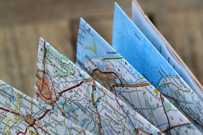
On a recent road trip in early November, while traveling north from St. Louis, Missouri to my home in the Quad Cities of Iowa, I encountered first rain, then snow, making the 4+ hour trip quite hazardous. I was using the map app on my Smartphone when ice began to accumulate and suddenly I lost all connection to the internet. I do not know if the cell towers were affected or if the information beaming down from a satellite could not get through, but I was saved by the fact that I had brought along my Rand McNally Road Atlas.

|
| Source: Pixabay |
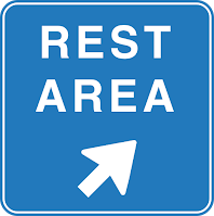
I eventually made it safely home a couple hours later than normal, but I was grateful that I could easily locate each rest area to clean off the car. Luckily I knew what highways to take, having made this trip many times, but it was handy to be able to check the route via my Rand McNally Road Atlas without a working GPS monitor.
History of Rand McNally
The Rand McNally Road Atlas has been in publication for over 160 years. The company began in 1868 when Andrew McNally and William Rand (Rand McNally) took over the Chicago Tribune's printing shop and began to print tickets and timetables for Chicago's booming railroads, which are the nation's premier railroad hub.
- In 1904, Rand McNally published the very first automobile road map. It was of New York City and it's vicinity.
- On a map of Peoria, Illinois in 1917, the company debuted a new highway numbering system which eventually became the model for the system used across the United States today.
- The first full-color Rand McNally Road Atlas premiered in 1960.
Throughout the years, the company continued to publish railway tickets and timetables. They have expanded over time to include many products used extensively today by many industries. By merging with or acquiring other companies in the field, they developed an electronic system for delivery of routing and mileage information to the trucking industries (1980), are now a leading school map and globe publisher (1984), and are a leading producer of consumer and business-to-business maps and atlases (1993). They also introduced TripMaker® software (1994) and StreetFinder® street navigation software (1996) for travel planning on personal computers.
These are just a few of the many products Rand McNally produces today. Here is a handy link if you want to read all about their interesting history.
Summary

|
| Source: Pixabay |
In 2016, Rand McNally celebrated its 160th birthday and 80th year in the commercial transportation market. I have done a lot of traveling from one side of this great country to the other in my life and have always had a current road atlas. Even with today's helpful electronics and technology, having a real 'map' I can look things up on is a standard accessory for my 'road trips'. My most recent trip in terrible Midwest weather in November proved to me that the Rand McNally Road Atlas is a travel necessity.


We never leave home without our Rand McNally Road Atlas! First, I want to comment on how you really are an admirable independent Elf. I think that ice and snow accumulating on my windshield would probably prompt me to seek out a hotel instead of rest stops and a water bottle. Second, I am actually surprised that I learned something new about these atlases. I had no idea they marked the rest stops and I use them all of the time. I guess that just shows how I get so goal oriented that I miss some truly excellent details. I doubt seriously the GPS technology will ever replace the Rand McNally Road Atlas for us. I truly think everyone should have one in every car, whether they have a GPS or Smartphone or not. You have provided an excellent reason why. In certain conditions, the electronic equipment simply will not work.
ReplyDeleteThanks for the compliment, Mouse. I REALLY should have stayed another day at my daughter's (or left the day before when it was 65 degrees in St. Louis with GOOD road conditions - if I'd had any sense... LOL). My problem was I had to be at work the following day back home, so really couldn't stay overnight either where I was or on the way. I had HOPED that the rain would not turn to snow until I was nearly home, but only 1/3 of the way the ice began, then the snow, and it quickly became a mess. Then I couldn't believe that my map app stopped working. One should really never depend so heavily on electronic devices that could fail without notice! So it was helpful that I had my brand spanking new Rand McNally road map with me, as I always do on trips, just like you. The smeary windshield was my biggest problem. Driving on the roads was not too bad as road crews were out immediately keeping the interstate mostly clear. It was not being able to see well that really freaked me out. :) I will not be taking any road trips in inclement weather again!
DeleteI couldn't agree more with you on having this atlas in your car! Yes, we have GPS but honestly we need a backup just in case! Everything being so automated is a bit scary. I'm not sure if we have one in our car as we haven't been traveling but your article is nudging me to get one just in case. And glad you had one for the situation you found yourself in, scary.
ReplyDeleteI've learned to not depend completely on electronics, Barbara. I had no idea my Google Map app on my phone was going to quit on me in the snowstorm. Having my road atlas along really helped.
DeleteSometimes the old technology is the best. I have been led astray by Google Maps and on board mapping services. It is so frustrating when you have a voice telling you over and over again to make a U-turn when you know that you are headed in the right direction. Give me a good map any day and I will put it to use.
ReplyDeleteI agree with you, Olivia. I've been led astray before too. Thanks for visiting.
DeleteI actually prefer to use a physical road map. In the area where I live, GPS is often unreliable, and there just might still be dragons here in the Wild West.
ReplyDeleteI know what you mean, Diana. I've been in-between cell towers before and completely lost the signal to my GPS. Cell towers are few and far between as yet in the western part of the U.S., so hands-on maps are more reliable in those places.
DeleteAlthough I don't drive, my husband is a car nut and we often take road trips. Even though he has a great sense of direction, we've gotten lost from time to time. And when that happens in hazardous conditions, it's frightening! Our atlas has saved our bacon more than once. I agree that it's a must-have! I'm glad you were able to make it home safe and sound, despite what sounds like a harrowing trip.
ReplyDeleteYes, it was rather 'harrowing' on that trip, Margaret. Had no idea the weather was going to deteriorate so rapidly that trip. Driving some 275 miles between St. Louis and Davenport, IA there is Springfield IL and Peoria IL and virtually nothing else. Even gas stations are few and far between going north in Illinois outside those two major cities. So help is not readily available. I was lucky to get home safely with only a few anxious moments here and there due to the weather.
DeleteThere is definitely a place for old school maps! GPS and map apps can be very inaccurate - glad you made it through quite a harrowing trip!
ReplyDelete